
Maverick Pro
by Code Sector
Version 10,000+ 💾 3 Mb
📅 Updated Learn More
Off-road GPS navigator with offline maps support, compass and track recording.

Features Maverick Pro
Use offline maps and GPS even without an internet connection.
This app is great for hiking, boating, geocaching and other outdoor activities.• Multiple global online maps: MapQuest, Open Street Maps (Cycle, Public Transport), Bing, Yandex, Ovi/Nokia, OpenSeaMap.• Multiple regional online maps: Ordnance Survey (OS Maps - UK), USGS Topo, NOAA RNC Charts (US), Canada Toporama, OutdoorActive (Germany, Austria, South Tyrol), Esri (Topo, Physical, Imagery, National Geographic, Oceans), HikeBikeMap (Germany), UMP-pcPL, Trail.pl (Poland), GSI (Japan), NearMap (Australia), New Zealand Topo and many other maps.All maps automatically cached for offline use.
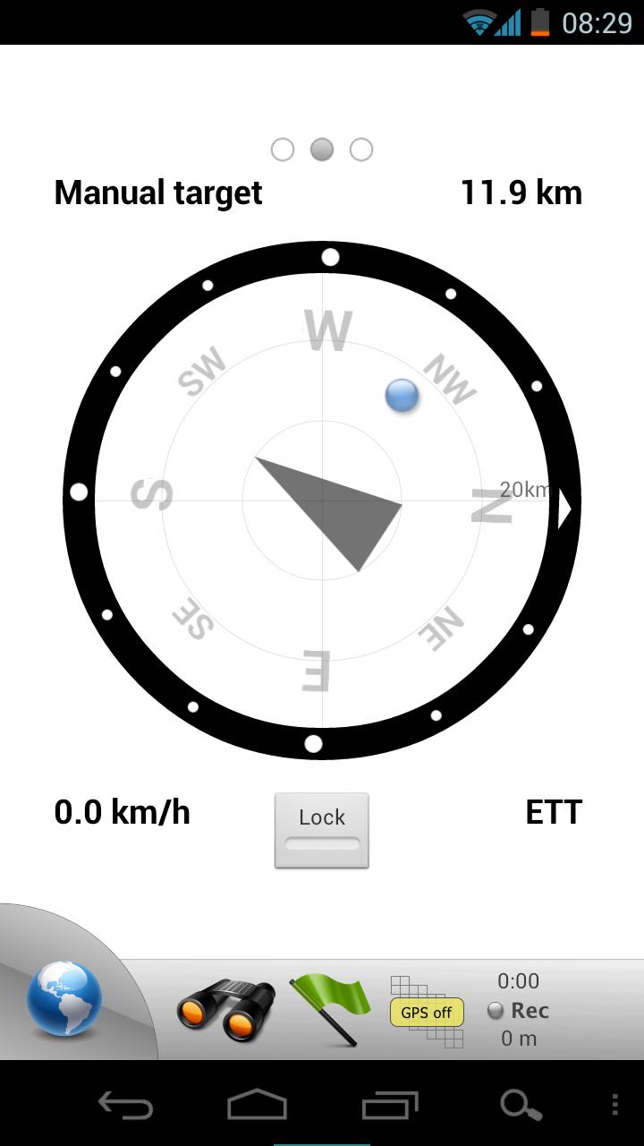
Use Mobile Atlas Creator to download maps or MAPC2MAPC to convert maps from other formats.Since version 2.0 you can add custom map servers.• Share your current or planned positionYou can send address, GPS coordinates, link to Google Maps and even map image.• Navigate easilyBuild-in radar shows the direction, distance and estimated time to a point of interest.
See all the nearest locations from FourSquare and Footprints.• Find your way backTrackback function will guide you along a previously recorded track with compass pointing to a nearest point.
A new track can be recorded at the same time.
• Challenge yourselfTurn on Trackback and timer to watch your previous position correlated with the current time on track.• Save places you visitAll waypoint stored in KML file and can be viewed and edited in Google Earth.
• Record tracks with single tapTracks are recorded in GPX format and can be viewed in Google Earth and other software.
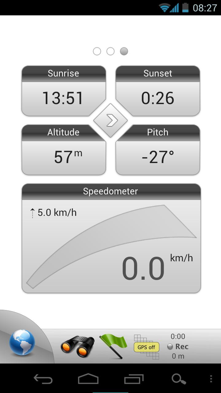
Share GPX files via email or DropBox.• Upload tracks to GPSiesFree account is required for uploading.• Trip ComputerWatch speed, altitude, pitch and many other values.• Support for Honeycomb, Ice Cream Sandwich and KitKat.• Ability to use barometer sensor in Galaxy Nexus and other devices.Only in Pro version:• Trackback feature• Unlimited waypoints and tracks• Multiple files with waypoints• Lock compass to bearing• UTM and OSGB grids• Custom map servers• FourSquare and Wikipedia supportVersion 2.8:- What 3 words support- BugfixesVersion 2.73:- Support for Android M.- Fixed Hike and Bike Map.- Removed Yandex Maps because of licensing issues.Version 2.7:- OS Explorer maps fix.Version 2.6:New tiles downloader.
You can "paint" areas to download with one finger or select a rectangle block using multi-touch.Beta versions are available in this community:https://plus.google.com/u/0/communities/103645541588926845443
Social Features
Connect and share with friends and the community.
Weather Features
Get accurate weather forecasts and real-time updates.
Fitness Tracking
Track your workouts and monitor your health metrics.
See the Maverick Pro in Action
What Our Users Say
Don't just take our word for it. Here's what our users have to say about our Android app.
"Perfect"
Aleksandar Golob
"Great app but some issues/bugs. 1. Track recording stops when screen is off and kept in pocket. 'Always screen on' is there but when you keep the phone in pocket, the screen is bound to be accidentally touched. 2. India specific topography maps not available. Please resolve these issues. Thank you."
Narendra Gachchi
"Doesn't load any map tiles. Developer contact email does not exist."
mike h
"Excellent app, but update locations regularly pls."
laxman kumar
"If you like walking, this app is a must. Well worth it, to the point of being a necessity. Access to ordnance survey maps is a huge bonus. It's a shame it isn't supported anymore"
Mark Smith
"Two stars. Used to be 5 but can't download any maps"
B Happy
"This app is very good except I cannot get it to export tracks using the function within the app. I found the folder where they're stored so I can do it manually but it should work as per described app functionality. I'm using the paid version."
Geoff Cooper
"Unable to send kml file"
Manoj Singh
"Was the best, put is now a dead app. No support now really slow. Shame."
Andy Carr
"Used it for years.. but recently more and more maps are unavailable or broken.. can't trust it anymore :( what a shame."
Jay ###
Get the App Today
Available for Android 8.0 and above